It is located 23 km from Quito and 15 km from Machachi; It has an area of 21.5 km2. Etymologically, Uyumbicho means: Uyum = around; yumbo = dancer, Indian; cho, cha = hot valley, that means: “Hot valley where the Indian dances around him”.
A long street takes us to the heart of Uyumbicho. The houses on its edge told us of a past lived by a caste that left its name imprinted as legend.
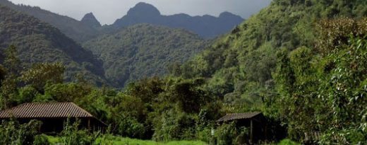
Located in the arms of the great avenue of the volcanoes, having as a tutelary hill the extinct Pasochoa volcano and constituting itself as a lookout point par excellence, at present it is the shelter of the last redoubts of Andean forest.
Uyumbicho Church
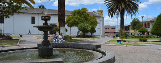
The Luzarine priest, Pedro Brunning, made possible the construction of this church, which conserves classical European material and form. The main, gold-plated altarpiece features the images of the Virgin Rosario, Saint Anthony of Padua, Saint Francis, and Saint Christopher (patron of the parish).
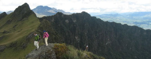
Pasochoa Wildlife Refuge
To reach the refuge from Mejía, take the southern-bound Panamericana highway, towards the community, “El Ejido de Amaguaña.” Then, take the cobblestone road, next to the church, for approximately 6km, passing the community “San Pedro de Pilopata,” until arriving at the parking lot.
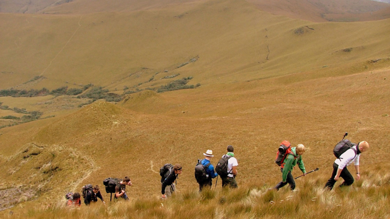
To the west, one can see the large collapsed volcano caldera, covered by dense forest; its far-east horizon shows evidence of the jagged bluffs. In this refuge, visitors may make the climb up Pasochoa volcano, and explore the paths to see the Andean flora and fauna. Included in this wildlife is a wide variety of birds native to this ecosystem. Permitted activities in this protected area are hiking, photography, and camping.
Pasochoa Volcano
Pasochoa (4,210m altitude) is an inactive volcano. Its caldera measures 2km in diameter, opening towards the east. It has the form of a large chamber, on whose walls and floor grows the Andean forest that the refuge protects. It is located between the Santa Ana and Sambache ravines.
From its heights flows the water that forms the San Pedro river, tributary of Guayllabamba. Hiking level is considered at medium difficulty.


 José Mejía E-50 y Bolívar
(Frente al Parque Central de Machachi)
Phone: 381 9250 Ext. 162
José Mejía E-50 y Bolívar
(Frente al Parque Central de Machachi)
Phone: 381 9250 Ext. 162
